

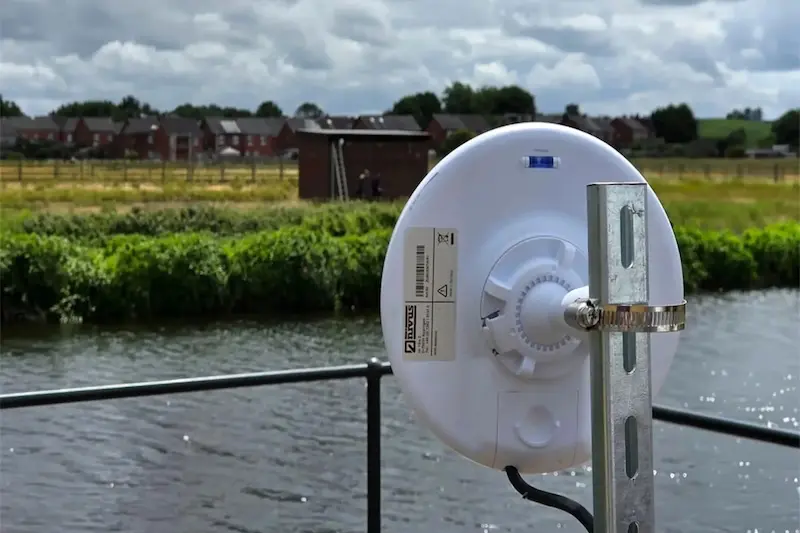
Wireless transit-time technology is modernising wireless river monitoring for engineers and environmental agencies by providing real-time flow data without the need for disruptive cross-river cabling. These cableless systems simplify installation and allow for more flexible sensor placement.
While accurate data is vital for flood warnings, water management, and environmental protection, traditional gauging methods are often hindered by installation complexity. Conventional setups require physical cables across the riverbed, often leading to costly civil works, trenching, and environmental disruption.
Wireless systems resolve these challenges by using high-accuracy ultrasonic measurement and inter-bank wireless communication. This removes the requirement for physical cable crossings, offering utilities and consultants a less invasive and more efficient method to capture critical data from optimal hydraulic locations.
What is wireless river monitoring?
Wireless river monitoring uses connected measurement systems to collect flow data from rivers and surface waters without relying on manual readings or fixed cable infrastructure across the channel.
In wireless transit time flow measurement, ultrasonic sensors are installed on opposite riverbanks. These sensors send signals across the water and measure how long they take to travel upstream and downstream.
Because the signal moves slightly faster with the flow and slightly slower against it, the system can calculate water velocity. This velocity data is then combined with channel geometry to calculate flow.
The key development is that both sides of the system communicate wirelessly. This removes the need for a physical cable between riverbanks while still supporting accurate real-time measurement.
How wireless river monitoring works
The principle is straightforward.
Ultrasonic sensors are placed on opposite riverbanks. They transmit signals diagonally across the water, both with and against the direction of flow.
The system measures the difference in travel time between the upstream and downstream signals. From this, it calculates flow velocity.
Using multiple measurement paths creates a more detailed velocity profile across the channel. NIVUS’ NivuFlow 650 supports up to 32 measurement paths, path lengths up to 200 m and a wireless range up to 300 m. It can also operate as a self-sufficient system using solar power and a battery supply.
This makes it especially useful for wider rivers, remote locations and sites where cable installation would be costly or disruptive.
Why wireless river monitoring is different
Traditional river gauging often involves practical compromises.
Sites may be selected because they are easy to access or close to an existing bridge, rather than because they are hydraulically ideal. That may simplify installation, but it can affect data quality.
Wireless transit time monitoring gives engineers more freedom to select sites based on flow conditions, channel geometry and monitoring objectives.
That means better data from better locations.
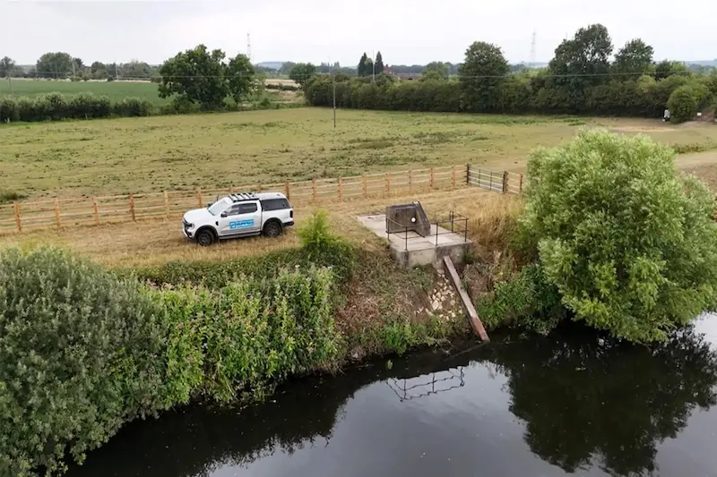
Why wireless river monitoring reduces installation complexity
The clearest advantage is the removal of the physical cable crossing.
No cable across the river means less civil work, less disruption and fewer limitations around bridges, trenches or access points.
Traditional cable-based systems may involve:
- trenching or ducting across a riverbed
- armoured cables between banks
- permits and environmental controls
- works in sensitive or protected areas
- access or traffic management near bridges
- high installation and maintenance costs
By removing the need for cross-river cabling, wireless transit time systems can reduce both installation cost and project risk.
NIVUS Wireless Transit Time technology has already been installed in many rivers across the UK, showing that the approach is not theoretical. It is already being used in real-world river monitoring environments.
4 key benefits of wireless river monitoring
#1. Better site selection
Hydrometric quality depends on good site selection.
A wireless system allows engineers to choose a location based on hydraulic suitability, rather than being forced towards an existing crossing or structure.
This supports better long-term flow data.
#2. Real-time flow data
For flood warning, abstraction management, drought monitoring and compliance applications, real-time data can be far more useful than periodic manual readings.
Live dashboards, automated alerts and historical trends help teams respond faster and make better-informed decisions.
#3. Reduced environmental impact
River environments can be sensitive.
Avoiding trenching, underwater cables and major civil works reduces disturbance to riverbeds, banks and surrounding habitats.
This is particularly valuable for protected watercourses or locations where permitting and access are challenging.
#4. Stronger data for decision-making
Environmental and water management decisions depend on reliable data.
Wireless monitoring provides accurate flow information from locations that may previously have been difficult or uneconomical to measure.
That supports better reporting, stronger flood planning, improved abstraction management and more confident environmental decision-making.
Applications for wireless river monitoring
Wireless transit time monitoring is well suited to sites where accurate surface water flow data is needed, but conventional installation is difficult.
Typical applications include:
- fluvial flood protection and warning
- river gauging and hydrometric networks
- abstraction and intake monitoring
- environmental and ecological monitoring
- drought control and low-flow assessment
- irrigation networks
- power station intake or cooling water monitoring
- remote catchment monitoring
- regulatory and compliance programmes
Flood warnings
Real-time flow measurement can improve the quality and speed of flood warning data.
Instead of relying on intermittent readings or less suitable measurement points, monitoring teams can collect continuous flow data from locations selected for hydraulic performance.
That gives flood management teams a clearer picture of changing river conditions.
Environmental compliance
Environmental teams need accurate, defensible data.
Wireless river monitoring can support long-term catchment assessment, abstraction monitoring, discharge impact studies and ecological protection, particularly where traditional installation would be disruptive or impractical.
For agencies, utilities and consultants, this can strengthen both operational decisions and reporting confidence.
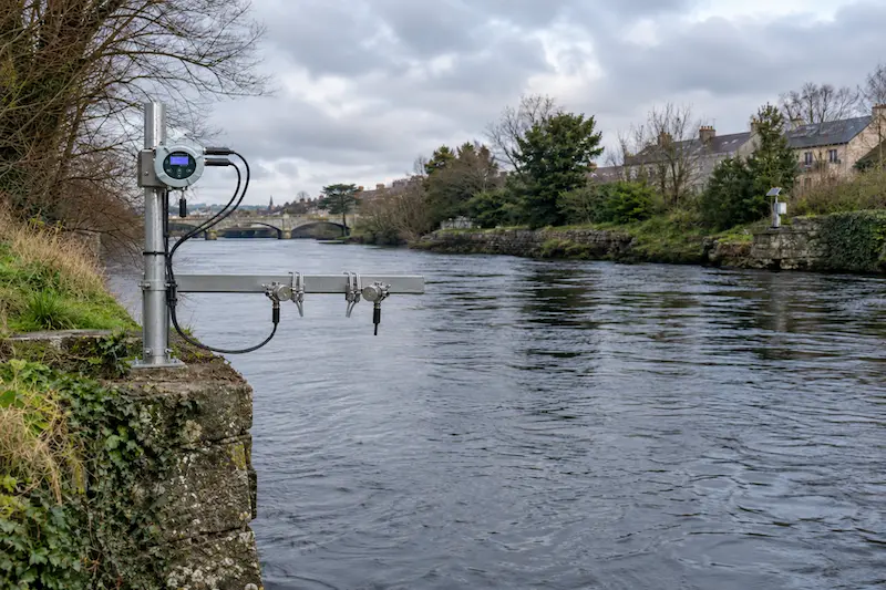
A case in point: Rethinking river monitoring on the Liffey
The River Liffey is an important watercourse running to the capital, exactly the type of watercourse where this technology could become highly relevant.
It has environmental, recreational, flood management and infrastructure significance. A wireless transit time monitoring installation could support a more detailed understanding of flow conditions without requiring disruptive cross-river cabling.
This is where the opportunity becomes interesting.
If many UK rivers are already using NIVUS Wireless Transit Time technology, then Irish rivers could benefit from this monitoring approach. A River Liffey deployment would show how the same approach can support real-time surface water monitoring in an Irish context.
A typical project process could include:
- Site assessment: Review hydraulic conditions, access, bank stability, channel geometry, signal path suitability and power options.
- System design: Select sensor locations, measurement paths, mounting hardware, power supply and data transmission requirements.
- Installation planning: Consider permissions, safety requirements, environmental controls and commissioning windows.
- Sensor and communication setup: Install sensors on both banks, configure wireless communication and synchronise timing via GPS/GNSS.
- Commissioning and validation: Confirm signal quality, verify readings, configure flow calculation and test data transmission.
- Cloud monitoring and alarms: Connect data to dashboards, trends, alerts and reporting workflows where required.
- Maintenance and support: Schedule inspections, calibration checks and technical support to keep the system reliable.
For a location like the Liffey, the value is not simply that the system is wireless. The value is that monitoring can be designed around the river’s hydraulic behaviour, not the nearest practical cable route.
Why work with a technical monitoring partner?
Wireless river monitoring is not just about choosing an instrument.
The accuracy and reliability of the final data depend on the full measurement chain: site selection, sensor placement, hydraulic conditions, power supply, communications, commissioning, validation and ongoing maintenance.
At Process Networks, we support our customers across measurement, automation and monitoring projects, from single instruments to complete multi-point systems.
For river and environmental monitoring, that end-to-end approach matters.
A strong system is more than the sensor; it’s a full solution from field measurement to usable data, backed by technical knowledge and responsive support.
A new standard for real-time river flow data
Wireless river monitoring gives water and environmental teams more freedom.
Instead of asking, “Where can we practically install a gauge?”, engineers can ask, “Where will the best data come from?”
With cableless transit time measurement, self-sufficient power options, multi-path velocity profiling, and real-time data transmission, river flow monitoring becomes more flexible, less disruptive and better suited to modern environmental decision-making.
For utilities, agencies and engineering teams, the opportunity is clear: more reliable flow data, from better locations, with less installation complexity.
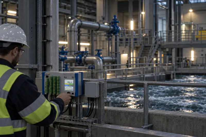
Wireless river monitoring delivered by Process Networks
Ready to measure river flow from the right location, not just the easiest one?
Process Networks can help you design and deliver a wireless river monitoring solution built around NIVUS Wireless Transit Time technology, giving you accurate real-time flow data without disruptive cross-river cabling. With up to 32 measurement paths, path lengths up to 200 m, wireless range up to 300 m and self-sufficient solar and battery power options, the NivuFlow 650 system makes precise monitoring possible on large, remote or sensitive river sites.
Whether you need better data for flood warning, abstraction monitoring, environmental reporting, drought control or long-term waterway management, we’ll help you assess the site, select the right configuration and turn river conditions into reliable, actionable insight.
Speak to our experienced team about wireless river monitoring for your river, catchment or surface water monitoring project.